TL;DR
Listen free for 30 days with Audible
Thousands of audiobooks and originals — cancel anytime.
Start your free trialAs an affiliate, we earn on qualifying purchases.
French firefighters have observed a pyrocumulonimbus cloud for the first time during a wildfire. This rare weather phenomenon indicates intensified fire behavior and atmospheric impacts. The event raises concerns about wildfire management and climate effects.
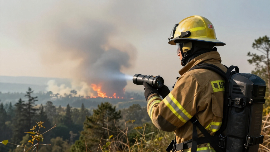
French firefighters have reported the first confirmed occurrence of a pyrocumulonimbus cloud during a wildfire in southern France. This atmospheric phenomenon, caused by intense heat and smoke, can influence weather patterns and fire behavior. The event is significant as it marks a rare observation in Europe and raises concerns about escalating wildfire severity amid climate change.
According to the French Civil Protection authorities, firefighters observed a pyrocumulonimbus cloud forming over the wildfire zone in the Provence-Alpes-Côte d’Azur region on March 24, 2024. Experts describe pyrocumulonimbus as a type of thunderstorm cloud generated by the intense heat of large fires, capable of producing lightning, strong winds, and even fire tornadoes.
Fire officials confirmed that this is the first documented case of such a cloud formation in France. Meteorologists from the French National Weather Service have verified the cloud’s characteristics using satellite imagery and ground-based observations. The cloud was observed to reach altitudes of approximately 12,000 meters, with visible lightning activity reported within the cloud.
Environmental scientists note that pyrocumulonimbus formation is more common in regions like Australia or North America during severe wildfires, but it is rarely seen in Europe. The phenomenon can exacerbate fire spread and complicate firefighting efforts, as lightning or strong winds generated within the cloud can ignite new fires or intensify existing ones.
Implications of Pyrocumulonimbus Formation in Europe
The occurrence of a pyrocumulonimbus cloud in France signifies a potential shift in wildfire behavior, driven by increasingly intense fires linked to climate change. Such clouds can generate lightning without rain, potentially igniting new fires and making firefighting more challenging. The event underscores the need for updated fire management strategies and highlights the atmospheric impacts of large-scale wildfires in Europe.
Experts warn that if such phenomena become more frequent, they could contribute to more unpredictable and severe fire seasons, with broader implications for regional climate and air quality. The event also raises awareness about the importance of monitoring fire weather conditions and atmospheric responses to large fires.
firefighter thermal imaging camera
As an affiliate, we earn on qualifying purchases.
As an affiliate, we earn on qualifying purchases.
Historical and Scientific Context of Pyrocumulonimbus Events
Pyrocumulonimbus clouds are rare but well-documented in regions with frequent large wildfires, such as Australia, North America, and Russia. These clouds form when intense heat from a wildfire causes strong convection, leading to cloud development and storm formation. Historically, Europe has seen fewer such events, making this French occurrence notable.
Scientists have studied pyrocumulonimbus phenomena since the early 2000s, recognizing their role in fire spread and atmospheric chemistry. The phenomenon can produce lightning, which can ignite new fires, and influence weather patterns by injecting smoke and aerosols into the upper atmosphere. The recent observation in France indicates a possible increase in such events, possibly linked to more extreme fire conditions driven by climate change.
“This is the first time we’ve documented a pyrocumulonimbus cloud in France. It shows how intense fires are becoming capable of generating their own weather systems.”
— Dr. Marie Dubois, Meteorologist
Uncertainties About Future Pyrocumulonimbus Events in Europe
It remains unclear whether this event indicates an increase in frequency of pyrocumulonimbus clouds in Europe or if it is an isolated occurrence. Scientists are still studying the conditions that led to this formation and whether climate change will make such events more common.
Further research is needed to determine if similar events will become a regular feature of European wildfire seasons and how they might influence fire management policies.
Monitoring and Research on Pyrocumulonimbus in Europe
Meteorological agencies and fire authorities will continue monitoring atmospheric responses to large fires, with particular attention to storm formation. Researchers plan to analyze satellite data and conduct modeling studies to assess the likelihood of more frequent pyrocumulonimbus events in Europe.
Authorities may also review firefighting protocols to account for the risks posed by such storm clouds, including lightning strikes and rapid fire spread. Public awareness campaigns on fire safety and climate resilience are expected to increase as part of broader wildfire preparedness efforts.
Key Questions
What is a pyrocumulonimbus cloud?
A pyrocumulonimbus is a thunderstorm cloud generated by intense heat from a large fire, capable of producing lightning, strong winds, and sometimes fire tornadoes.
Why is this event in France significant?
This is the first documented case of a pyrocumulonimbus cloud forming in France, indicating changing fire behavior and atmospheric responses in Europe.
Could this lead to more severe wildfires?
Yes, such clouds can trigger lightning and strong winds, which may ignite new fires and make existing fires harder to control, potentially leading to more severe wildfire conditions.
Is climate change linked to this event?
While direct causation is complex, climate change is associated with more extreme fire conditions that could increase the likelihood of pyrocumulonimbus formation.
Will this affect firefighting strategies in Europe?
Yes, authorities may need to adapt firefighting tactics to account for storm formation and lightning risks associated with pyrocumulonimbus clouds.
Source: hn
NFL season / tailgating Picks
team gear
As an affiliate, we earn on qualifying purchases.